Monday, 7 March 2011

Brittany - Beg Meil to Cap Coz

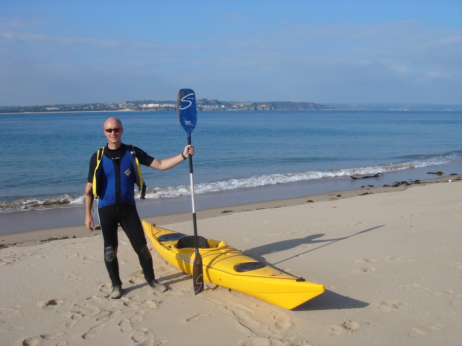
We were staying at the little coastal village of Beg Meil in south west Brittany, France, a short walk from the beach.  The Atlantic breakers make for some interesting kayaking  - but just round the headland is the relative shelter of the Bay of Concarneau.  

One of the places we wanted to explore was the resort of Cap Coz, about a four mile (six kilometre) paddle across the bay.  Cap Coz is popular for sailing and water sports and has a long white sandy beach. Un bon endroit pour faire du kayak!

Round the headland

We waited for a day with light winds and picked our moment to easily paddle through the surf on the sandy beach at Beg Meil.  We quickly reached the headland and  went out to sea to give it a wide berth, as the waves were crashing on it dramatically and there were big jagged rocks sticking out of the water.

It should have been an easy paddle but we were head to the wind, which had picked up again, making it a tiring effort to stay on course.  It was a bright sunny day, however, and we could see the sheltered bay ahead of us.

Across the bay to Cap Coz  

The conditions were completely different in the bay, which is a couple of miles across and has boat moorings dotted all over.  We could just about make out Cap Coz in the distance as it had little dinghys with brightly coloured sails on the beach.

We arrived at the gently sloping white sandy beach, an ideal location for anyone new to kayaking in Brittany, as it had good facilities and is within eacy reach of the historic fishing port of Concarneau, with its walled city and ancient harbour.

Back through the breakers

After spending the afternoon at Cap Coz we headed back across the bay and realised that the sea was really picking up.  We had thought it was a bit rough around the headland before but now it was a real battle just to get round. 

Once we were pointing towards the beach at Beg Meil, it was all a matter of timing.  The beach had been deserted when we left but was quite busy by that time, so we had plenty of spectators to watch us surf the breakers, paddling really fast to stay on line and returning dramatically through the breakers – fortunately without wiping out at the last moment!  Bon amusement! 

Rounding the headland at Beg Meil

Cap Coz in Brittany


Tuesday, 1 March 2011

The Helford River, Cornwall

We rented a farmhouse with a private mooring on Gillan Creek, just south of the Helford River in Cornwall.  It is very tidal and we realised that we had to launch before breakfast if we wanted to catch the rising tide.  This turned out to be the making of out holiday on the Helford, as the river is definitely at its best on a clear spring morning as the sea mist is just lifting.
 
In the shelter of the creek the river was like glass, without a ripple.  We could see Herons and white Egrets as we made our way out to sea past the 12th century village of St Anthony-in-Meneage with its Norman church and across the causeway that can be walked across at low tide. (We tried this later and it makes a useful short cut.)

Out to sea

Once you round the headland at Dennis Head you are actually in the Atlantic and on a clear day can see the commercial port and town of Falmouth in the distance.  Surprisingly we noticed some swans had followed us out to sea - the first time I’ve ever seen that. There were small breakers hitting the jagged rocks of the coast so I can imagine that rounding the headland can be quite challenging in rougher weather, as there is nothing between Falmouth and America. 

Into the Helford

We finally entered the Helford the water calmed down again quickly. The whole of the  Helford Estuary has recently been designated as a Special Area of Conservation (SAC) and it is easy to see why, as there is nearly 30 miles of shoreline, providing an enormous variety of habitats.

In the time we were there we didn’t even get to the famous Frenchman’s Creek or up to the head of the river to the thriving boatyard at Gweek Quay – but we will definitely return.


Map of the Helford River

Friday, 18 February 2011

Tenby to Caldey Island

Caldey Island is a mile or so off the coast of South Wales at Tenby. Caldey is actually made up of two islands, Caldey itself and, off its western tip, St Margaret's, home to thousands of cormorants. Famous for the monastery, the monks of Caldey Abbey are Cistercians and live according to strict rules (which I think include no women or kayaking).  As a paddle, Caldey has a bit of everything and if you are feeling adventurous you can go right round it. 

Tides and sea conditons

The best place to leave from is the sandy south beach at Tenby, which has a good car park. There is a slipway of sorts across the sand but the tide goes out a long way so it can be a long carry.   Sea conditions vary a lot, so it is important to check the forecast as well as the tides. Setting off from the south beach, it is just possible on a clear day to make out the landing on Priory beach. 

The prevailing current sweeps towards this shore, so the outward trip is a fairly easy paddle, depending on the cross winds.  There is a buoy at the half way mark which helps keep you on course and I usually stop at it for a rest.

Deserted Island

In the summer the Island is popular with tourists who pay £11 (just under $18 – a good reason to travel by kayak!) to make the crossing on boats from Tenby Harbour.  Out of season, however, I have landed on the beautifully unspoilt Priory beach - without so much as a Cistercian monk in sight. 

There is a bit of an unpredictable rip tide if the sea gets up and swirls around the island but that only adds to the enjoyment of this satisfying Pembrokeshire paddle. 


On Prioriy Beach, Caldey Island

( YouTube Video of a large group of Caldey Island kayakers )
 

Tuesday, 15 February 2011

Lostwithiel Tudor Bridge

Fowey (pronounced Foy) is one of my favourite rivers in Cornwall.  From the natural harbour at the picturesque town of Fowey on the south coast, the river is navigable by kayak six miles up to the Tudor bridge at the ancient town of Lostwithiel.  You do have to be very accurate with the tide, however, as the river has become heavily silted and as the tide goes out huge areas of sticky black mud are revealed.

We picked our day well for a paddle from Fowey to Lostwithiel, a distance of about six miles.  The Harbour Master was very helpful, allowing us to launch our kayaks for free from his slipway and giving us advice about the rising tide.  The challenge with this trip is to still have enough water to actually get under the 16th Century Tudor bridge at the top of the river.

Sawmills Studio Golant

On the way up we visited the tiny village of Golant and the nearby creek with the famous Sawmills recording studio, where groups including Oasis, The Verve and Supergrass have done some of their best recording.  A little further up we stopped at the intriguing 19th Century Garibaldi's boathouse, now deserted but allegedly a royal hide away for the Prince of Wales (later Edward VII) and Lily Langtry, as it is only accessible from the water.  As we continued up river the river changes into a meandering creek and we could feel the tide turn, so had to work harder with it against us to reach the Bridge at Lostwithiel.

Lostwithiel Tudor Bridge
We were in luck when we arrived, as there was about a foot of water and we were able to pass underneath. (In November 2010 Lostwithiel suffered one of the worst floods on record and the Tudor Bridge was almost inundated.)   The trip back was fast with the running of the outgoing tide and we arrived back a Fowey at the end of one of the best river kayaking trips in the UK.
Going under the Tudor bridge at Lostwithiel

Monday, 14 February 2011

Coniston Water

All I knew about Coniston Water was that world speed record holder Donald Campbell met his end there in 1967 in the Bluebird.  A long, straight and fairly narrow strip of water, Coniston is the third biggest lake in the English Lake District, at five miles (8 km) long and only half a mile (800 m) at the widest point.  It is also one of the deepest, at 184 feet (56 m).  Sheltered from prevailing winds by mountains, the lake is dominated by an impressive peak called the ‘Old Man of Coniston’.

Perfect flat water

We arrived early and had the entire lake to ourselves and paid a couple of pounds to launch from the main shingle ‘beach’.  We headed up to the end where Campbell and his jet boat were recovered - as recently as 2000 after years of searching by divers.  Early in the morning Coniston is the most sheltered and peaceful lake I have ever kayaked, although it does get busier in the season once the pleasure boats start up.

Ruskin’s House at Brantwood

Famous Victorian John Ruskin’s house marks the mid way point as you paddle along the length of the lake.  Ruskin had a jetty built and used a rowing boat of his own design on the lake (it wasn’t a very good design, so he called it the ‘Jumping Jenny’ and it can still be seen in his boathouse).

Yachts and boats

It is a long lake so by the time you get to near the top the sailing yachts and pleasure boats are probably running. They are quite fast so you need to keep a look out, but quite interesting as one is an original Victorian Gondola, first launched in 1859 and restored by the National Trust.  We planned to arrive back at our launch site before lunch, as Coniston village has some good pubs and shops, so we saved going right to the top for next time.  We will definitely go back as it is one of my favorite lakes. 

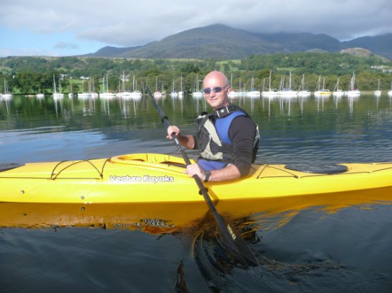
Me on Coniston Water with the 'Old Man' in the background

Sunday, 13 February 2011

Symonds Yat

A day on the River Wye

The Wye at Symonds Yat is one of UK kayaking's hidden treasures.  I lived within 40 minutes drive of it for years before I discovered it - and now it has to be one of my favourite kayaking rivers.  The high spot is the man-made rapids - but if you want something more leisurely there are miles of relatively still water up and downstream of Symonds Yat to explore.

Shooting the Symonds Yat rapids

Before going over the rapids for the first time it is a good idea to watch others for a while to see how to do it - or how not, as plenty of people are caught out by the rocks in the middle!  The first time I went over the rapids there had been a lot a rain and the Wye was running fast and high.  I planned my ‘route’ and carefully approached (and yes, I was a bit nervous as I’d seen a few wipe-outs so was ready to bale out if necessary). 

It felt like being in a kayak at the top of a flight of stairs, but there was no going back.  The tranquil silence of the river was suddenly replaced with the roar of white water and I shot through, heading straight for the big rock in the middle.  I’m not sure if it’s instinct or training but I dug the paddle in deep and just cleared it by seconds, emerging at the bottom the right way up with a huge grin that lasted most of the day. 

Rapids definitely make you a better kayaker, as after that I could tackle anything smaller with a lot more confidence.

Me going over the rapids at Symonds Yat